
ANRA Technologies Debuts VISTA to Give Drone Pilots a Sharper View of Crowded Skies
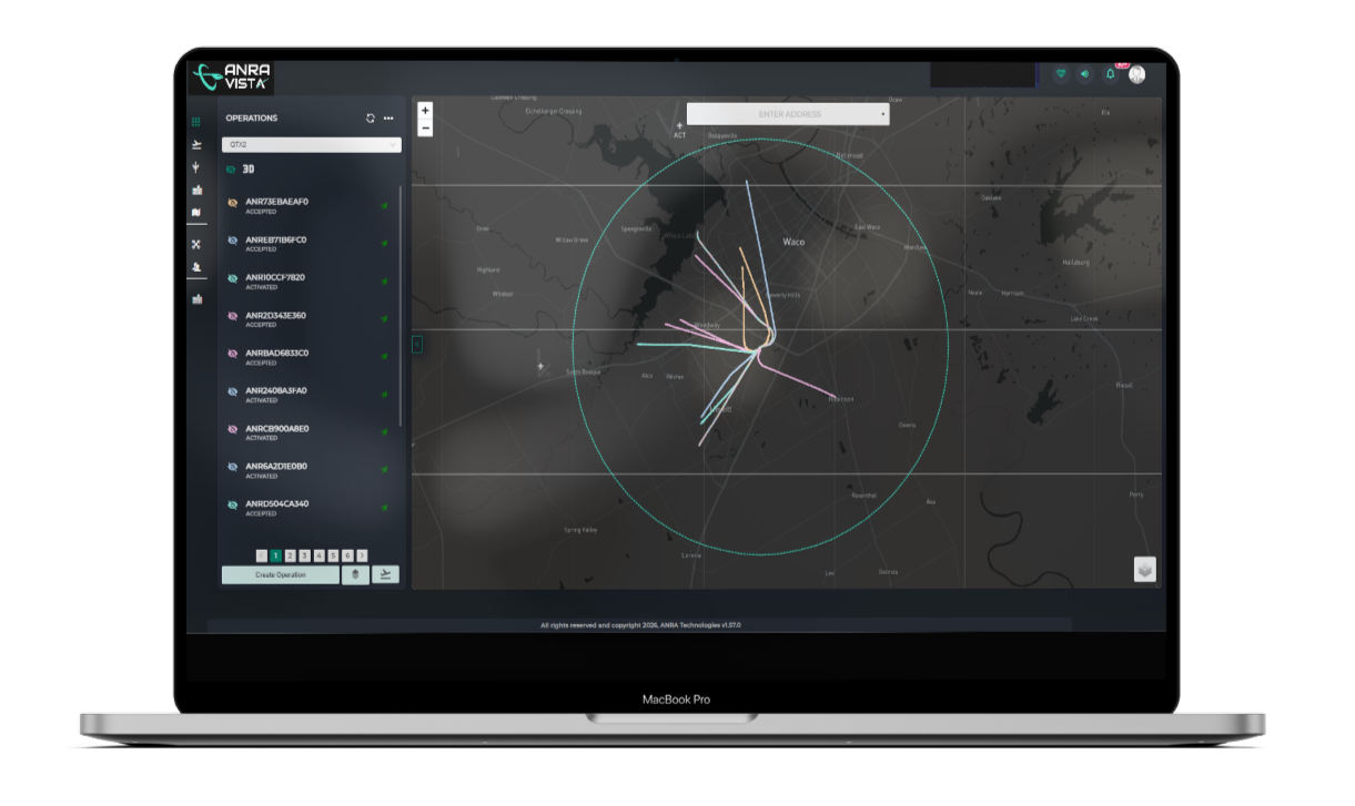
Drone operators who worry about what else is flying near their mission area now have another tool to lean on. ANRA Technologies has rolled out an application called VISTA — short for Visual Interface for Shared Traffic Awareness — which pulls in flight-intent and position data from Uncrewed Aircraft System Traffic Management (UTM) services and presents it in a visual layout. The launch was made public on 14 October 2026.
The app targets a fairly broad audience: public safety agencies, commercial drone outfits, and organisations that fly for tasks such as checking infrastructure or running delivery routes. Its core function is straightforward — it shows whatever information is available about nearby drone flight intentions and reported positions, giving pilots a clearer picture of the traffic around them. As low-altitude airspace grows busier, ANRA argues that operators often lack visibility into missions run by other organisations or managed through separate systems, which makes it harder to judge conditions before and during a flight.
Crucially, VISTA is not a replacement for existing tools. It works as a receive-only platform, meaning it does not link aircraft to UTM services or file flight plans on a user’s behalf. Instead, it acts as an extra layer of situational awareness that organisations can adopt without swapping out their current aircraft, flight apps, or operational systems. According to ANRA, that low-friction approach is deliberate, keeping disruption to a minimum for teams that simply want more information rather than a full platform migration.
The company highlights several practical uses: checking available data on flight intentions and reported positions around a mission area, displaying that shared data in a format pilots and support crews can read quickly, reviewing relevant drone activity before takeoff, and keeping an eye on other aircraft while airborne. Likely adopters include emergency services running Drone as First Responder programmes, where aircraft are sent near incident scenes, as well as utilities and infrastructure operators carrying out inspections and maintenance.
VISTA fits into ANRA’s broader UTM and airspace visualisation portfolio. The company says its UTM platform handles roughly one drone mission every 15 seconds during daytime operations, and that more than 20 organisations — mostly DFR programmes — already rely on its visualisation tools to track drone activity in their areas. Because the app depends on data shared through the UTM ecosystem, its value scales with how many participants contribute information; ANRA frames it as a complement to existing procedures rather than a substitute, with data from earlier uses potentially feeding back to sharpen the system over time.
Source: eVTOL Insights
What do you think?